Thursday, October 29, 2009

NASA Selects 18 University Proposals for Steckler Space Grants

0 comments
NASA has chosen 18 proposals from universities around the country to receive up to $70,000 for Phase One of the NASA Ralph Steckler Space Grant Colonization Research and Technology Development Opportunity.

Grant money will support university research and technology development activities that support a sustained human presence in space, increase understanding of the moon's environment and develop basic infrastructure for future space colonies.

"I'm excited that many of the awards will provide a dual benefit to exploration and to Earth conservation by focusing on important issues such as water recycling, food production and power storage," said Frank Prochaska, manager of the Steckler Space Grant Project at NASA's Johnson Space Center in Houston.

NASA selected two proposals from Cornell University in Ithaca, N.Y., and the University of Arizona in Tucson and one proposal from each of the following academic institutions:
  • Desert Research Institute in Reno
  • Massachusetts Institute of Technology in Cambridge
  • Montana State University in Bozeman
  • New Mexico State University in Las Cruces
  • Ohio Aerospace Institute in Cleveland
  • Old Dominion University Research Foundation in Norfolk, Va.
  • Pennsylvania State University in University Park
  • Texas Tech University System in Lubbock
  • University of California in San Diego
  • University of Central Florida in Orlando
  • University of Hartford in West Hartford, Conn.
  • University of Idaho in Moscow
  • University of North Texas in Denton
  • University of Wisconsin in Green Bay
The projects selected to receive Steckler Space Grants will be implemented through three funding and development phases. Phase One will last nine months with a maximum award up to $70,000. The purpose of Phase One is to establish the scientific and technical merit and feasibility of a proposed innovation, research, or technology development effort that could enable space colonization or settlement. Primary exploration elements include habitation, rovers, surface power, communications and extravehicular activity systems.

Phase Two, which lasts two years, will provide a maximum of $250,000 each to four of the most promising Phase One projects through a competitive selection based on scientific and technical merit. The purpose of Phase Two is to begin conducting the research and technology development effort. Two awards of up to $275,000 each will be given for the third phase, also two years, during which time the Phase Two efforts will be integrated with NASA programs or projects.

NASA received 35 proposals. The agency released the cooperative agreement notice inviting lead institutions of the National Space Grant College and Fellowship Program to submit proposals for these grants in November 2008. The Space Grant national network includes more than 850 affiliates from universities, colleges, industry, museums, science centers, and state and local agencies supporting and enhancing science and engineering education, research and public outreach efforts for NASA's aeronautics and space projects. These affiliates belong to one of 52 consortia in all 50 states, the District of Columbia and the Commonwealth of Puerto Rico.

Ralph Steckler was an assistant film director and photographer from southern California who had a lifelong interest in space colonization. He left part of his estate to NASA for the colonization of space and the betterment of mankind. Those funds are now providing universities with NASA research opportunities based on his vision.

With this program and NASA's other college and university programs, the agency continues its tradition of investing in the nation's education programs with the goal of developing science, technology, engineering and math skills and capabilities critical to achieving the nations' exploration goals.

For more information about NASA's education programs visit:

http://www.nasa.gov/education

Wednesday, October 28, 2009

John McTigue, Betty Love Honored as Eagles

0 comments
Retired NASA Dryden employees Betty Love and John McTigue have been honored as “2009 Eagles” by the Flight Test Historical FoundationRetired long-time NASA Dryden Flight Research Center employees John McTigue and Betty Love were among four individuals honored as 2009 Eagles by the Flight Test Historical Foundation during the group's annual Gathering of Eagles event Oct. 16. The foundation supports operation and improvements to the Air Force Flight Test Center Museum at Edwards Air Force Base.

This year's Gathering of Eagles, held at the Antelope Valley Fairgrounds in Lancaster, Calif., focused on the 50th anniversary of the X-15 rocket plane's first glide and powered flights.

After serving as project engineer of X-15 number three during his earlier years at NASA Dryden, McTigue went on to become the Deputy Director of Flight Operations and then Chief of the Flight Support Division at Dryden, then under the management of NASA's Ames Research Center. His well-earned reputation as an engineer and manager perched him perfectly as a 2009 Eagle.

Love began her NASA career as a human computer, preparing and reducing flight data on research projects over two decades from the X-1 to the X-15 eras. Her well-known "can do" attitude and encouragement to others during her working years, as well as her dedication to voluntarily supporting Dryden's history office to ensure accurate documentation of Dryden's illustrious history in recent years, earned her the well-deserved honor as an Eagle of the foundation.

Also honored as 2009 Eagles during the event were retired U.S. Air Force Maj. Gen. Robert White, a former X-15 pilot and Air Force Flight Test Center commander, and retired flight test engineer Robert Hoey, who supervised mission planning and data analysis for many Air Force / NASA X-15 flights.

Tuesday, October 27, 2009

GOES-P Satellite Preparing for Launch in March 2010

0 comments
The GOES-P instrument team is pictured here in the Boeing facility with the GOES-P satellite after completion of the instrument testingJust two months after the successful launch of the GOES-O spacecraft, now called GOES-14 in orbit, the NASA team removed the GOES-P spacecraft from storage and commenced its post storage testing. GOES-P is being prepared for an early March 2010 launch and if the launch schedule holds, it boasts an unprecedented two launches in approximately 8 months.

The GOES-P spacecraft completed its build late in 2006 (just after the launch of GOES-N) and since that time the spacecraft has been in storage at the Boeing Facility in El Segundo, California.

NASA has a commitment, to the National Oceanic and Atmospheric Administration (NOAA), for the launch of the GOES-P spacecraft in April 2010. The combined NASA and contractor teams (Boeing, ITT and LM) are working hard to meet their commitment and are now preparing the GOES–P spacecraft for shipment to the launch base. The project has recently completed a major milestone in the completion of its instrument testing.

During this testing, the NASA team demonstrated the instruments continue to function as expected and will meet the stringent mission requirements. The instruments include the Imager and Sounder, built by ITT, and the Solar X-Ray Imager built by Lockheed Martin.

With these activities completed the spacecraft will continue the testing of the spacecraft subsystems and mechanical activities. NASA is looking forward to completing these activities and the ensuing launch campaign.

Monday, October 26, 2009

Cassini Data Help Redraw Shape of Solar System

0 comments
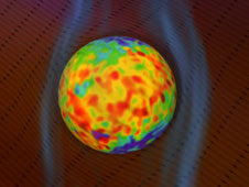
bubble around our solar systemImages from the Ion and Neutral Camera on NASA's Cassini spacecraft suggest that the heliosphere, the region of the sun's influence, may not have the comet-like shape predicted by existing models. In a paper published Oct. 15 in Science Express, researchers from the Johns Hopkins Applied Physics Laboratory present a new view of the heliosphere, and the forces that shape it.

"These images have revolutionized what we thought we knew for the past 50 years; the sun travels through the galaxy not like a comet but more like a big, round bubble," said Stamatios Krimigis of the Applied Physics Lab, in Laurel, Md., principal investigator for Cassini's Magnetospheric Imaging Instrument which carries the Ion and Neutral Camera. "It's amazing how a single new observation can change an entire concept that most scientists had taken as true for nearly fifty years."

As the solar wind flows from the sun, it carves out a bubble in the interstellar medium. Models of the boundary region between the heliosphere and interstellar medium have been based on the assumption that the relative flow of the interstellar medium and its collision with the solar wind dominate the interaction. This would create a foreshortened "nose" in the direction of the solar system's motion, and an elongated "tail" in the opposite direction.

The Ion and Neutral Camera images suggest that the solar wind's interaction with the interstellar medium is instead more significantly controlled by particle pressure and magnetic field energy density.

"The map we've created from the images suggests that pressure from a hot population of charged particles and interaction with the interstellar medium's magnetic field strongly influence the shape of the heliosphere," says Don Mitchell, Magnetospheric Imaging Instrument/Ion and Neutral Camera co-investigator at the Applied Physics Lab.

Since entering into orbit around Saturn in July of 2004, the Ion and Neutral Camera has been mapping energetic neutral atoms near the planet, as well as their dispersal across the entire sky. The energetic neutral atoms are produced by energetic protons, which are responsible for the outward pressure of the heliosphere beyond the interface where the solar wind collides with the interstellar medium, and which interact with the magnetic field of the interstellar medium.

"Energetic neutral atom imaging has demonstrated its power to reveal the distribution of energetic ions, first in Earth's own magnetosphere, next in the giant magnetosphere of Saturn and now throughout vast structures in space-out to the very edge of our sun's interaction with the interstellar medium," says Edmond C. Roelof, Magnetospheric Imaging Instrument co-investigator at the Applied Physics Lab.

The results from Cassini complement and extend findings from NASA's Interstellar Boundary Explorer, or IBEX, spacecraft. Data from IBEX and Cassini have made it possible for scientists to construct the first comprehensive sky map of our solar system and its location in the Milky Way galaxy.

Researchers from University of Arizona, Tucson; Southwest Research Institute, San Antonio; and University of Texas at San Antonio contributed to the article. The Cassini-Huygens mission is a cooperative project of NASA, the European Space Agency and the Italian Space Agency. The Jet Propulsion Laboratory, a division of the California Institute of Technology in Pasadena, manages the Cassini-Huygens mission for NASA's Science Mission Directorate, Washington. The Cassini orbiter was designed, developed and assembled at JPL. The Magnetospheric Imaging Instrument was developed by the Applied Physics Laboratory.

More information on the Cassini mission is available at: http://www.nasa.gov/cassini, http://saturn.jpl.nasa.gov and on the Magnetospheric Imaging Instrument Web site at http://sd-www.jhuapl.edu/CASSINI/ .

More information on the Interstellar Boundary Explorer is available at: http://www.nasa.gov/ibex

Friday, October 23, 2009

NASA Television to Broadcast Cargo Ship Arrival at Space Station

0 comments
The residents of the International Space Station will receive a new shipment of food, fuel and supplies at 8:41 p.m. CDT on Saturday, Oct. 17. NASA Television's coverage of the ship's arrival at the station will begin at 8:15 p.m.

The Russian ISS Progress 35 cargo ship, filled with more than two tons of supplies for the station, is set to launch from the Baikonur Cosmodrome in Kazakhstan on Wednesday, Oct. 14 at 8:14 p.m. There will be no television coverage of the launch.

Expedition 21 Commander Frank De Winne and Flight Engineers Jeff Williams, Nicole Stott, Roman Romanenko, Max Suraev and Bob Thirsk will observe the event from aboard the station as the unpiloted craft automatically docks to the station's Pirs Docking Compartment.

For NASA Television streaming video, downlink and schedule information, visit:

http://www.nasa.gov/ntv

For more about the International Space Station, visit:
http://www.nasa.gov/station

Wednesday, October 21, 2009

NASA Launches Tweetup for Space Shuttle Atlantis Liftoff in Florida

0 comments
For the first time, NASA Twitter followers are invited to view a space shuttle launch in person at the agency's Kennedy Space Center in Florida. NASA is hosting this unique Tweetup on Nov. 11 and 12. Space shuttle Atlantis is targeted to launch at 4:04 p.m. EST, Nov. 12 on its STS-129 mission to the International Space Station.

"This will be NASA's fifth Tweetup for our Twitter community," said Michael Cabbage, director of the News Services division at NASA Headquarters in Washington. "Each event has provided our followers with inside access to NASA personnel, including astronauts. The goal of this particular Tweetup is to share the excitement of a shuttle launch with a new audience."

NASA will accommodate the first 100 people who sign up on the Web. An additional 50 registrants will be added to a waitlist. Registration opens at noon EDT on Friday, Oct. 16. To sign up and for more information about the Tweetup, visit:

http://www.nasa.gov/tweetup

The two-day event will provide NASA Twitter followers with the opportunity to take a tour of NASA's Kennedy Space Center, view the space shuttle launch and speak with shuttle technicians, engineers, astronauts and managers. The Tweetup will include a "meet and greet" session to allow participants to mingle with fellow Tweeps and the staff behind the tweets on @NASA.

To follow NASA programs on Twitter visit:

http://www.nasa.gov/collaborate

For more information about space shuttle Atlantis' STS-129 mission, visit:

Tuesday, October 20, 2009

NASA to Reveal Data Showing a New View of Our Galaxy

0 comments
NASA will hold a NASA Science Update at 2:15 p.m. EDT on Thursday, Oct. 15, to discuss new science data of our galaxy obtained from the agency's Interstellar Boundary Explorer, or IBEX, spacecraft. NASA Television and the agency's Web site will provide live coverage of the briefing from the James E. Webb Memorial Auditorium at NASA Headquarters, 300 E St. SW, in Washington.

The briefing participants are:

- David McComas, IBEX spacecraft principal investigator and assistant vice president, Space Science and Engineering Division, Southwest Research Institute in San Antonio
- Eric Christian, IBEX deputy mission scientist, NASA's Goddard Space Flight Center in Greenbelt, Md.
- Rosine Lallement, senior scientist at the French National Center for Scientific Research in Paris
- Lindsay Bartolone, lead of Education and Public Outreach at the Adler Planetarium in Chicago
- Don Mitchell, Cassini spacecraft instrument scientist, IBEX co-Investigator, Johns Hopkins University Applied Physics Laboratory in Laurel, Md.

Reporters unable to attend the briefing may ask questions by telephone. To reserve a telephone line, journalists should e-mail their name, media affiliation and telephone number to Sonja Alexander at:

sonja.r.alexander@nasa.gov

For more information about NASA TV schedules, downlinks and streaming video, visit:

http://www.nasa.gov/ntv

Monday, October 19, 2009

Soyuz Landing Caps Historic Space Station Increment

0 comments
International Space Station Expedition 20 Commander Gennady Padalka and Flight Engineer Michael Barratt landed their Soyuz TMA-14 spacecraft on the steppes of Kazakhstan Sunday, wrapping up a six-month stay. Joining them was spaceflight participant Guy Laliberte, who spent 11 days in space.

Padalka, the Soyuz commander, guided the spacecraft to a parachute-assisted landing at 12:32 a.m. EDT at a site northeast of the town of Arkalyk.

Russian recovery teams were on hand within minutes of landing to help the crew exit from the Soyuz vehicle and reacclimate to gravity. The crew members will return to the Gagarin Cosmonaut Training Center in Star City, outside of Moscow, for reunions with their families.

Padalka and Barratt spent 199 days in space and 197 days on the station after their March 26 launch. Laliberte launched with the Expedition 21 crew on a Soyuz vehicle Sept. 30 and returned after nine days on the station.

Padalka and Barratt presided over the inauguration of a six-person crew and two space shuttle assembly and resupply missions to the station. They also were station crew members during the delivery of tons of cargo and new science facilities for expanded research, and the arrival of the first Japanese H-II Transfer cargo vehicle.

The station now is occupied by Expedition 21 Commander Frank De Winne of the European Space Agency and Flight Engineers Roman Romanenko and Max Suraev of Russia, Bob Thirsk of the Canadian Space Agency and Nicole Stott and Jeff Williams of NASA.

For information about the space station, visit:

http://www.nasa.gov/station

Friday, October 16, 2009

NASA to Rebroadcast Global Event from the Space Station

0 comments
NASA Television will rebroadcast the Oct. 9 global event International Space Station resident Guy Laliberte designed to raise awareness about the need for clean water. Laliberte, who founded Cirque du Soleil, hosts the event from aboard the station.

"Moving Stars and Earth for Water," will take place in 14 cities across five continents between 9 and 11 p.m. EDT, and will be streamed live on the Web site of Laliberte's ONE DROP foundation at:


NASA Television will re-air the entire broadcast beginning Saturday, Oct. 10, at 1 p.m. with encore broadcasts Oct. 11 and 12. For NASA TV streaming video, schedule and downlink information, visit:

http://www.nasa.gov/ntv

NASA signed a memorandum of understanding with Cirque du Soleil regarding the event, which will include video from aboard the space station and also discussion about water recycling aboard the station and about NASA technologies affecting everyday life. Event participants include former Vice President Al Gore, Canadian Space Agency astronaut Julie Payette, actress Salma Hayek and singers Shakira and Bono.

Laliberte flew to the station for a nine-day stay under an agreement between the Russian Federal Space Agency and Space Adventures, Ltd. He and two station crewmates, Mike Barratt and Gennady Padalka, will return to Earth on Sunday, Oct. 11.

For more information about the space station, visit:

http://www.nasa.gov/station

Thursday, October 15, 2009

NASA Selects High School Students for Inspire Education Program

0 comments
NASA has selected 1,732 high school students from 48 states, the District of Columbia and Puerto Rico to participate in its Interdisciplinary National Science Program Incorporating Research Experience, also known as Inspire. The Inspire project is designed to encourage students in grades nine through 12 to pursue careers in science, technology, engineering and mathematics.

The selectees will participate in an online learning community in which students and parents have the opportunity to interact with their peers and NASA engineers and scientists. It also provides appropriate grade-level educational activities, discussion boards and chat rooms for participants and their families to gain exposure to the many career opportunities at NASA.

The selected students will have the option to compete for workshops and internships at NASA facilities and participating universities throughout the nation during the summer of 2010. The summer experience provides students a hands-on opportunity to investigate careers in science, technology, engineering and mathematics.

The INSPIRE project is part of NASA's education efforts to engaging and retaining students in disciplines critical to the agency's missions.

For information about the program, visit:

http://www.nasa.gov/education/INSPIRE

For more information about NASA's education programs, visit:

http://www.nasa.gov/education

Wednesday, October 14, 2009

New Antenna May Reveal More Clues About Lightning

0 comments
University of Mississippi Professor Tom Marshall and student Lauren Vickers, say they hope their lightning tests using a newly designed antenna can produce results NASA can use for future launchesLaunch scrubs are nothing new at NASA's Kennedy Space Center. In fact, there have been 116 space shuttle scrubs; 72 for technical reasons and 45 for inclement weather.

During the summer, bad weather, particularly lightning, seems to strike as the countdown clock nears zero. Maybe it's because Kennedy and Cape Canaveral Air Force Station are well within what meteorologists call, "Lightning Alley."

Of course, NASA already can locate lightning strikes when they hit the ground with the Cloud to Ground Lightning Surveillance System, or CGLSS, and the National Lightning Detection Network. The agency also can locate lightning channels in a cloud with the Lightning Detection and Ranging Network, or LDAR II.

But according to Professor Tom Marshall of the University of Mississippi, humans have yet to truly figure out lightning. So, Marshall and one of his senior students, Lauren Vickers, visited Kennedy to test a new antenna that might someday measure the level of individual lightning flashes and their return strokes. A measurement that could give launch managers information to make their "go-no go" decisions easier... decisions that might save money.

"We're trying to extend some measurement of cloud-to-ground lightning here at Kennedy," Marshall said. "We may find a return stroke is larger, and therefore, one for us to target."

The strength of these strokes might someday determine if future launch vehicles, such as Ares I, must undergo testing if lightning strikes nearby.

"What Professor Marshall's work is going to enable us to do is determine more precisely than we can now exactly where charges are located in clouds and how big those charges are when lightning strikes," said Dr. Frank Merceret, director of research for the Kennedy Weather Office. "The problem lies in the fact that NASA does not know where the charge center is located in the clouds.

"The Lightning Advisory Panel (LAP), which develops and recommends our lightning launch commit criteria (LLCC), has been wrestling with that issue for quite some time and his project may give the panel information that will help provide more accurate lightning readings before a launch."

A launch vehicle traveling through an anvil cloud, a cloud mostly made of ice that forms on top of thunderstorms, can trigger lightning at much lower electric field levels than natural lightning requires. This triggered lightning can damage vehicles or its cargo. In 1987, an Atlas-Centaur rocket was destroyed when its launch triggered such lightning. To prevent such accidents, the LLCC -- a strict set of lightning avoidance rules -- was modified by the LAP.

The LAP, which is made up of top lightning experts from various government agencies and academia, continues to review and modify those criteria for both the Eastern and Western ranges.

University of Mississippi Professor Tom Marshall hopes to someday get several more new antenna lightning detectorsAlthough some launch weather guidelines involving shuttles and expendable rockets may differ because a distinction is made for the individual characteristics of each, the LLCC are identical for all vehicles.

"If the shuttle is on the launch pad and a lightning strike occurs nearby, we need to know the distance from the shuttle and the intensity of the lightning to determine if there are any possible effects on the vehicle. If the lightning was close enough and intense enough, operations, including a launch, will be delayed so the team can ensure the shuttle was not damaged," said Kathy Winters, shuttle launch weather officer.

During shuttle launch countdowns, weather forecasts are provided by the U. S. Air Force Range Weather Operations Facility at Cape Canaveral beginning at launch minus three days in coordination with the NOAA National Weather Service Space Flight Meteorology Group, or SMG, at the Johnson Space Center in Houston. These include weather trends and possible effects on launch day.

A formal prelaunch weather briefing is held on launch minus one day to discuss specific weather conditions for all areas of shuttle operations.

Launch weather forecasts, ground operations forecasts and launch weather briefings for the mission management team and the shuttle launch director are prepared by the shuttle launch weather officer.

Forecasts that apply after launch are prepared by SMG. These include all emergency landing forecasts and end-of-mission forecasts presented to the flight director and mission management team.

Tuesday, October 13, 2009

Arctic Sea Ice Extent is Third Lowest on Record

0 comments
Sea ice cover reaches its minimum extent at the end of each summer.U.S. satellite measurements show Arctic sea ice extent in 2009 – the area of the Arctic Ocean covered by floating ice – was the third lowest since satellite measurements were first made in 1979. The ice area at minimum was an increase from the past two years, but still well below the average for the past 30 years.

Arctic sea ice reached its minimum extent around September 12, as shown in the image and video to the right. According to scientists affiliated with the National Snow and Ice Data Center (NSIDC), sea ice coverage dropped to 5.10 million square kilometers (1.97 million square miles) at its minimum. The ice cover was 970,000 square kilometers (370,000 square miles) greater than the record low of 2007 and 580,000 square kilometers (220,000 square miles) greater than 2008.

NSIDC is sponsored by several U.S. government agencies, including NASA. Ice data are derived from measurements made by U.S. Department of Defense and NASA satellites, with key work in interpreting the data and developing the 30-year history done by scientists at NASA's Goddard Space Flight Center in Greenbelt, Md.

"The changes from year to year are interesting since there has been large variability," said Josefino Comiso, a sea ice expert at NASA Goddard. "But we need to look at several years of data to examine the long-term trends."

"Our three decades of continuous satellite measurements show a rapid decline of about 11.6 percent per decade," Comiso said. Arctic sea ice has declined about 34 percent since measurements were first made in the late 1970s.

The four lowest ice extents on record have occurred between 2005 and 2009, with the record minimum reached during a dramatic drop in ice cover in 2007 that was exacerbated by unusual polar winds.

Several recent studies based on data from NASA’s ICESat and QuikScat satellites have shown that, in addition to shrinking geographic ice coverage, the amount of multi-year ice cover – thicker ice that survives more than one summer -- has been declining in recent years.

Tom Wagner, NASA's cryosphere program manager, describes the shrinking of Arctic sea ice and the significance of the problem for the rest of the planet."The oceans are crucial to Earth's climate system, since they store huge amounts of heat," said Comiso. "Changes in sea ice cover can lead to circulation changes not just in the Arctic Ocean, but also in the Atlantic and Pacific oceans. If you change ocean circulation, you change the world's climate."

Changes in the Arctic ice cover could also mean a new paradigm for life in the sea. "The waters at high latitudes are some of the most biologically productive in the world because of the presence of sea ice," Comiso added. "Many of our richest fisheries are the seas around the Arctic Ocean, and we don't know what the consequences might be if the seasonal sea ice disappears in these regions."

Related links:

> Arctic Sea Ice News and Analysis
> NASA Satellite Reveals Dramatic Arctic Ice Thinning
> Satellites and Submarines Give the Skinny on Sea Ice Thickness
> Satellites Show Arctic Literally on Thin Ice

Monday, October 12, 2009

NASA's LCROSS Mission Changes Impact Crater

0 comments
NASA's Lunar Crater Observation and Sensing Satellite mission (LCROSS) based on new analysis of available lunar data, has shifted the target crater from Cabeus A to Cabeus (proper).

The decision was based on continued evaluation of all available data and consultation/input from members of the LCROSS Science Team and the scientific community, including impact experts, ground and space based observers, and observations from Lunar Reconnaissance Orbiter (LRO), Lunar Prospector (LP), Chandrayaan-1 and JAXA's Kaguya spacecraft. This decision was prompted by the current best understanding of hydrogen concentrations in the Cabeus region, including cross-correlation between the latest LRO results and LP data sets.

The general consensus of lunar experts led by the LCROSS science team is that Cabeus shows, with the greatest level of certainty, the highest hydrogen concentrations at the south pole. Further consideration of the most current terrain models provided by JAXA's Kaguya spacecraft and the LRO Lunar Orbiter Laser Altimeter (LOLA) was important in the decision process.The models show a small valley in an otherwise tall Cabeus perimeter ridge, which will allow for sunlight to illuminate the ejecta cloud on Oct. 9, and much sooner than previously estimated for Cabeus. While the ejecta does have to fly to higher elevations to be observed by Earth assets, a shadow cast by a large hill along the Cabeus ridge, provides an excellent, high-contrast, back drop for ejecta and vapor measurements.

The LCROSS team concluded that Cabeus provided the best chance for meeting its mission goals. The team critically assessed and successfully advocated for the change with the Lunar Precursor Robotic Program (LPRP) office. The change in impact crater was factored into LCROSS' most recent Trajectory Correction Maneuver, TCM7.

During the last days of the mission, the LCROSS team will continue to refine the exact point of impact within Cabeus crater to avoid rough spots, and to maximize solar illumination of the debris plume and Earth observations.

Thursday, October 8, 2009

NASA Ice Campaign Takes Flight in Antarctica

0 comments
Early in the 20th century, a succession of adventurers and scientists pioneered the exploration of Antarctica. A century later, they're still at it, albeit with a different set of tools. This fall, a team of modern explorers will fly over Earth's southern ice-covered regions to study changes to its sea ice, ice sheets, and glaciers as part of NASA's Operation Ice Bridge.

Starting next month, NASA will fly its DC-8, a 157-foot-long airborne laboratory that can accommodate many instruments. The fall 2009 campaign is one of few excursions to the remote continent made by the DC-8, the largest aircraft in NASA's airborne science fleet.

The plane is scheduled to leave NASA's Dryden Flight Research Center in Edwards, Calif., on October 12 and fly to Punta Arenas, Chile, where the plane, crew and researchers will be based for through mid-November. For six weeks, the Ice Bridge team will traverse the Southern Ocean for up to 17 flights over West Antarctica, the Antarctic Peninsula, and coastal areas where sea ice is prevalent. Each round-trip flight lasts about 11 hours, two-thirds of that time devoted to getting to and from Antarctica.

Operation Ice Bridge is a six-year campaign of annual flights to each of Earth's polar regions. The first flights in March and April carried researchers over Greenland and the Arctic Ocean. This fall's Antarctic campaign, led by principal investigator Seelye Martin of the University of Washington, will begin the first sustained airborne research effort of its kind over the continent. Data collected by researchers will help scientists bridge the gap between NASA's Ice, Cloud and Land Elevation Satellite (ICESat) -- which is operating the last of its three lasers -- and ICESat-II, scheduled to launch in 2014.

The Ice Bridge flights will help scientists maintain the record of changes to sea ice and ice sheets that have been collected since 2003 by ICESat. The flights will lack the continent-wide coverage that can be achieved by satellite, so researchers carefully select key target locations. But the flights will also turn up new information not possible from orbit, such as the shape of the terrain below the ice.

"Space-based instruments like the ICESat lasers are the only way to find out where change is occurring in remote, continent-sized ice sheets like Antarctica," said Tom Wagner, cryosphere program scientist at NASA Headquarters in Washington, D.C. "But aircraft missions like Ice Bridge allow us to follow up with more detailed studies and make other measurements critical to modeling sea level rise."

Lasers and Radars

ICESat launched in January 2003 and since then, its sole instrument -- a precise laser altimeter -- has helped scientists map ice sheet elevation, calculate sea ice thickness, and monitor how both have changed.

"With ICESat, we have seen significant changes, things we wouldn't otherwise know were taking place," said Jay Zwally of NASA's Goddard Space Flight Center in Greenbelt, Md., and ICESat investigator on the mission. For example, shifts in surface elevation have previously revealed the draining and filling of lakes below Antarctica's ice.

After ICESat, scientists will rely on an airborne laser called the Airborne Topographic Mapper (ATM), developed at NASA Wallops Flight Facility in Wallops Island, Va. ATM pulses laser light in circular scans on the ground, and those pulses reflect back to the aircraft and are converted into elevation maps of the ice surface. By flying ATM over the same swath of ground covered by ICESat, researchers can compare the two data sets and calibrate them so that aircraft can continue the record keeping after the satellite data ends. They can also make more detailed elevation studies over dynamic areas, such as the Crane glacier on the Antarctic Peninsula, which sped up following the collapse of the Larsen Ice Shelf in 2002.

In addition, University of Kansas scientists will fly the Multichannel Coherent Radar Depth Sounder, which measures ice sheet thickness. It can also map the varied terrain below the ice, which is important for computer modeling of the future behavior of the ice.

The Laser Vegetation Imaging Sensor, developed at Goddard, will map large areas of sea ice and glacier zones. And a gravimeter, managed by Columbia University, will measure the shape of seawater-filled cavities at the edge of some major fast-moving major glaciers. Finally, a snow radar from University of Kansas will measure the thickness of snow on top of sea ice and glaciers, allowing researchers to differentiate between snow and ice and make more accurate thickness measurements.

Targets

The Antarctic continent may be remote, but it plays a significant role in Earth's climate system. The expanse is home to glaciers and ice sheets that hold frozen about 90 percent of Earth's freshwater -- a large potential contribution to sea level rise should all the ice melt.

How and where are Antarctica's ice sheets, glaciers, and sea ice changing? Compared to the Arctic, where sea ice has long been on the decline, sea ice in Antarctica is growing in some coastal areas. Snow and ice have been accumulating in some land regions in the east. West Antarctica and the Peninsula, however, have seen more dramatic warming and rapid ice loss.

"We don't see the same sea ice changes in Antarctica that we see in the Arctic, and the reason is that the system is more complex," said Thorsten Markus of NASA Goddard, the principal sea ice investigator for the mission. "But the fact that we don't see the same changes in Antarctica that we see in the Arctic doesn’t make it less important to study those changes. It's really important for us to understand the global climate system."

With the DC-8 limited to just a few hours over Antarctica on each flight, mission planners have carefully selected targets of current and potential rapid change.

One such target is West Antarctica's Pine Island Glacier. "That glacier is one of the great unknowns because its bed -- where the glacier contacts rock -- is below sea level," Martin said. "So if there's a surge or dramatic change, seawater could get under the glacier and we could be looking at very rapid change."

Other proposed targets along the Amundsen coast include the Thwaites, Smith, and Kohler glaciers and the Getz Ice Shelf. Researchers also intend to study the myriad glaciers and ice shelves on the Peninsula, which has been undergoing dramatic changes.

"A remarkable change is happening on the Earth, truly one of the biggest changes in environmental conditions on Earth since the end of the ice age," Wagner said. "It's not an easy thing to observe, let alone predict what might happen next. Studies like this one are key."

Links:

Operation Ice Bridge
http://www.nasa.gov/topics/earth/features/ice_bridge/index.html

Wednesday, October 7, 2009

Cosmic Rays Hit Space Age High

0 comments
Energetic iron nuclei counted by the Cosmic Ray Isotope Spectrometer on NASA's Advanced Composition Explorer (ACE) spacecraft reveal that cosmic ray levels have jumped 19% above the previous Space Age highPlanning a trip to Mars? Take plenty of shielding. According to sensors on NASA's ACE (Advanced Composition Explorer) spacecraft, galactic cosmic rays have just hit a Space Age high.

"In 2009, cosmic ray intensities have increased 19% beyond anything we've seen in the past 50 years," says Richard Mewaldt of Caltech. "The increase is significant, and it could mean we need to re-think how much radiation shielding astronauts take with them on deep-space missions."

The cause of the surge is solar minimum, a deep lull in solar activity that began around 2007 and continues today. Researchers have long known that cosmic rays go up when solar activity goes down. Right now solar activity is as weak as it has been in modern times, setting the stage for what Mewaldt calls "a perfect storm of cosmic rays."

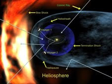
An artist's concept of the heliosphere, a magnetic bubble that partially protects the solar system from cosmic rays"We're experiencing the deepest solar minimum in nearly a century," says Dean Pesnell of the Goddard Space Flight Center, "so it is no surprise that cosmic rays are at record levels for the Space Age."

Galactic cosmic rays come from outside the solar system. They are subatomic particles--mainly protons but also some heavy nuclei--accelerated to almost light speed by distant supernova explosions. Cosmic rays cause "air showers" of secondary particles when they hit Earth's atmosphere; they pose a health hazard to astronauts; and a single cosmic ray can disable a satellite if it hits an unlucky integrated circuit.

The sun's magnetic field is our first line of defense against these highly-charged, energetic particles. The entire solar system from Mercury to Pluto and beyond is surrounded by a bubble of solar magnetism called "the heliosphere." It springs from the sun's inner magnetic dynamo and is inflated to gargantuan proportions by the solar wind. When a cosmic ray tries to enter the solar system, it must fight through the heliosphere's outer layers; and if it makes it inside, there is a thicket of magnetic fields waiting to scatter and deflect the intruder.

"At times of low solar activity, this natural shielding is weakened, and more cosmic rays are able to reach the inner solar system," explains Pesnell.

The heliospheric current sheet is shaped like a ballerina's skirt.Mewaldt lists three aspects of the current solar minimum that are combining to create the perfect storm:
  1. The sun's magnetic field is weak. "There has been a sharp decline in the sun's interplanetary magnetic field (IMF) down to only 4 nanoTesla (nT) from typical values of 6 to 8 nT," he says. "This record-low IMF undoubtedly contributes to the record-high cosmic ray fluxes."
  2. The solar wind is flagging. "Measurements by the Ulysses spacecraft show that solar wind pressure is at a 50-year low," he continues, "so the magnetic bubble that protects the solar system is not being inflated as much as usual." A smaller bubble gives cosmic rays a shorter-shot into the solar system. Once a cosmic ray enters the solar system, it must "swim upstream" against the solar wind. Solar wind speeds have dropped to very low levels in 2008 and 2009, making it easier than usual for a cosmic ray to proceed.
  3. The current sheet is flattening. Imagine the sun wearing a ballerina's skirt as wide as the entire solar system with an electrical current flowing along the wavy folds. That is the "heliospheric current sheet," a vast transition zone where the polarity of the sun's magnetic field changes from plus (north) to minus (south). The current sheet is important because cosmic rays tend to be guided by its folds. Lately, the current sheet has been flattening itself out, allowing cosmic rays more direct access to the inner solar system.
"If the flattening continues as it has in previous solar minima, we could see cosmic ray fluxes jump all the way to 30% above previous Space Age highs," predicts Mewaldt.

Earth is in no great peril from the extra cosmic rays. The planet's atmosphere and magnetic field combine to form a formidable shield against space radiation, protecting humans on the surface. Indeed, we've weathered storms much worse than this. Hundreds of years ago, cosmic ray fluxes were at least 200% higher than they are now. Researchers know this because when cosmic rays hit the atmosphere, they produce an isotope of beryllium, 10Be, which is preserved in polar ice. By examining ice cores, it is possible to estimate cosmic ray fluxes more than a thousand years into the past. Even with the recent surge, cosmic rays today are much weaker than they have been at times in the past millennium.

"The space era has so far experienced a time of relatively low cosmic ray activity," says Mewaldt. "We may now be returning to levels typical of past centuries."

Tuesday, October 6, 2009

The Ups and Downs of Global Warming

0 comments
According to the vast majority of climate scientists, the planet is heating up. Scientists have concluded that this appears to be the result of increased human emissions of greenhouse gases, especially carbon dioxide, which trap heat near the surface of Earth. However, some information sources -- blogs, websites, media articles and other voices -- highlight that the planet has been cooling since a peak in global temperature in 1998. This cooling is only part of the picture, according to a recent study that has looked at the world's temperature record over the past century or more.

In their recently published research paper2 entitled "Is the climate warming or cooling?", The world's surface air temperature change (David Easterling of the U.S. National Climate Data Center and Michael Wehner of Lawrence Berkeley National Laboratory show that naturally occurring periods of no warming or even slight cooling can easily be part of a longer-term pattern of global warming.

This may sound counter-intuitive at first sight, so let's take a closer look at the data. Figure 1 shows the change in the world's air temperature averaged over all the land and ocean between 1975 and 2008. The warming is obvious -- about 0.5° C (0.9° F) during that time. However, there are plenty of periods -- 1997 to 1985 and 1981 to 1989 (see insets, Figure 1), and 1998 to 2008 -- when no warming is seen, the most recent of which some global warming skeptics say is evidence that the world is actually cooling.

What's going on? To answer this question, Easterling and Wehner pored over global temperature records dating from 1901 to 2008 and also ran computer simulations of Earth's climate looking back into the past and forward into the future. They concluded that in a climate being warmed by man-made carbon emissions, "it is possible, and indeed likely, to have a period as long as a decade or two of 'cooling' or no warming superimposed on a longer-term warming trend."

Natural Fluctuations

These temperature plateaus, or cooling spells, can be attributed to natural climate variability, explains Josh Willis, a climate scientist at NASA's Jet Propulsion Laboratory in Pasadena, Calif. and a recent recipient of the 2009 Presidential Early Career Award for Scientists and Engineers. "Natural variability refers to naturally-occurring fluctuations or events that change Earth's climate on time scales ranging from years to decades. Big volcanic eruptions, for instance, can cause cooling that lasts for several years. When a volcano erupts, it blasts dust into the upper atmosphere where it reflects sunlight and cools the planet, a bit like a natural umbrella." He goes on, "There are also all kinds of natural fluctuations that sometimes cause warming, sometimes cooling." Ocean changes, for instance, can have a big impact on the world's temperature. One example that Willis cites is the Pacific Decadal Oscillation, a pattern of warmer and cooler surface temperatures in the Pacific Ocean that can last between 10 and 30 years.

Another important example is El Niño, which is an abnormal warming of surface ocean waters in the eastern tropical Pacific that happens every three to eight years and can affect global temperatures for a year or two. Between 1997 and 1998, there was an unusually strong El Niño, and this caused 1998 to be one of the hottest years on record (Figure 1). When Easterling and Wehner dropped the 1998 temperature spike from the data altogether, and zoomed in on the readings from 1999 to 2008, they saw a strong warming trend over this period. But when the 1998 measurement is included in the data, it looks as if there is no overall warming between 1998 and 2008 at all.

The authors say that it is easy to "cherry-pick" a period to reinforce a particular point of view. "Claims that global warming is not occurring that are derived from a cooling observed over short time periods ignore natural variability and are misleading."

What you have to look at, says Willis, is the long-term temperature readings that have been collected over the past century -- which is exactly what Easterling and Wehner do in their study. Over that sort of time scale, global warming becomes apparent from observations of both our atmosphere and our ocean, which are intimately linked pieces of the climate puzzle.

Sea Change

Since around the time of the Industrial Revolution (the late 18th and early 19th centuries), Earth's atmosphere has warmed by a little less than 1° C (1.8° F) (Figure 2). In turn, the ocean has also risen by about 15 centimeters (6 inches) over the past 100 years -- for two reasons. First, when water warms up, it expands, in much the same way as a solid does when it heats up. As the volume of seawater increases, it causes sea level to rise. Second, global warming causes glaciers and ice sheets to melt, which adds more water to the world's ocean, again causing sea level to rise 4,5.

The world's average surface air temperature change anomaly from 1880 to the present day

"If you look at the ocean data, there has been a very clear acceleration in sea level rise," explains Willis. "At the beginning of the last century, sea level was rising by less than 1 millimeter (0.04 inches) per year; mid-century it was 2 millimeters (0.08 inches) per year and now it's 3 millimeters (0.12 inches) per year. This is directly caused by the increasing temperature of the planet."

Big Picture

As Willis explains, global warming is a long-term process. "Despite the fact it's been warmer and cooler at different times in the last 10 years, there's no part of the last 10 years that isn't warmer than the temperatures we saw 100 years ago."

Assuming our greenhouse gas emissions continue at their present levels with little reduction, existing climate forecasts suggest that our planet will warm by about 4° C (7.2° F) by the end of the 21st century. Although scientists continue to study the nuances of Earth's climate, the link between carbon emissions, global warming and sea level rise over the past century is clear. Even if our global carbon emissions began to fall tomorrow, Earth would continue to warm for some time due to the inertia of the climate system.

"In the next century it's definitely going to get warmer," Willis says. "You don't need a crystal ball or fancy climate model to say that. Just look at the sea level and temperature records from the past 100 years -- they're all going up." Likewise, Easterling and Wehner's work reminds us that understanding climate change -- one of the most important challenges we face today -- requires a long-term view. "Unlike people," says Willis, "the climate has a very long memory."


A Body of Evidence

In 2007, a scientific intergovernmental body called the Intergovernmental Panel on Climate Change (IPCC) released its Fourth Assessment Report on Climate Change, which summarizes our current understanding of climate change. The report took 6 years to produce, involved over 2500 scientific expert reviewers and more than 800 authors from over 130 countries.

Some of their key findings include:

  • The warming trend over the last 50 years (about 0.13° C or 0.23° F per decade) is nearly twice that for the last 100 years.
  • The average amount of water vapor in the atmosphere has increased since at least the 1980s over land and ocean. The increase is broadly consistent with the extra water vapor that warmer air can hold.
  • Since 1961, the average temperature of the global ocean down to depths of at least 3 km (1.9 miles) has increased. The ocean has been absorbing more than 80% of the heat added to the climate system, causing seawater to expand and contributing to sea level rise.
  • Global average sea level rose on average by 1.8 mm (0.07 inches) per year from 1961 to 2003. There is high confidence that the rate of observed sea level rise increased from the 19th to the 20th century.
  • Average arctic temperatures increased at almost twice the global average rate in the past 100 years.
  • Mountain glaciers and snow cover have declined on average in both hemispheres. Widespread decreases in glaciers and ice caps have contributed to sea level rise.
  • Long-term trends in the amount of precipitation have been observed over many large regions from 1900 to 2005.

Monday, October 5, 2009

Ames Bioengineering Scientist Establishes GREEN Team

0 comments
Image of Jonathan TrentAfter earning his Ph.D. in Biological Oceanography at Scripps Institution of Oceanography, University of California at San Diego, Jonathan Trent spent six years in Europe at the Max Planck Institute for Biochemistry in Germany, the University of Copenhagen in Denmark, and the University of Paris at Orsay in France. He returned to the United States to work at the Boyer Center for Molecular Medicine at Yale Medical School for two years before establishing a biotechnology group at the Department of Energy's Argonne National Laboratory in Illinois.

In 1998, he moved to NASA Ames Research Center, where he established the Protein Nanotechnology Group. These researchers focus on building nanostructures using biomolecules from extremophiles-organisms adapted to extreme environments, such as high temperatures, high or low pH, ionizing radiation, or saturated salts. Using these robust biomolecules, and manipulating molecular recognition and self-assembly with genetic engineering, his team has built patterned nano-particle arrays for data storage and molecular scaffolds for enhancing enzyme activities.

In addition to working at NASA, Trent was appointed Adjunct Professor in the Dept. of Biomolecular Engineering at the University of California at Santa Cruz in 2004. Two years later, he was awarded the prestigious Nano50 award for Innovation in Nanotechnology, and was elected Fellow of the California Academy of Sciences. Since then, Trent has initiated Global Research into Energy and the Environment at NASA (GREEN) with support from Google. Among other projects, Trent and the GREEN team are developing systems for producing a sustainable, carbon-neutral feedstock for the biofuels of the future. Trent's recent research and inventions are focused on methods for obtaining alternative fuels, processing municipal wastewater, and economically producing freshwater by desalination. In April 2009, he organized and led an international conference in Denmark entitled: Wind, Sea, and Algae.

Friday, October 2, 2009

NASA Engineers to Practice on Webb Telescope Simulator

0 comments
The huge assembly standing in Northrop Grumman Corporation’s high bay looks a lot like NASA's James Webb Space Telescope, but it’s a full-scale simulator of the space telescope’s key elements.

This photograph shows simulators of the James Webb Space Telescope's optical telescope element and the sunshield's integrated validation article, mated together in Northrop Grumman's high bay in Space ParkEngineers are using the simulator, consisting of the telescope’s primary backplane assembly and the sunshield’s integrated validation article, to develop the Webb Telescope’s hardware design. In addition, technicians are using it to gain experience handling large elements in advance of working with the actual hardware that will fly in space.

"Having a functioning demonstration article enables us to see how components, which were developed and tested individually, fit together as a whole system," said Martin Mohan, Webb Telescope program manager for Northrop Grumman Aerospace Systems sector. "The simulator is an effective risk reduction tool to help us validate design approaches early."

John E. Decker, Deputy Associate Director for the Webb Telescope at NASA's Goddard Space Flight Center said, "Simulators are important for the development of any spacecraft, and they are absolutely critical for one with the size and complexity of the Webb Telescope. We have already learned many important lessons from this simulator, and we expect to learn many more."

The simulator is a key element in the company’s extensive test and verification program, which relies on incremental verification, testing, and the use of crosschecks throughout the Webb Telescope’s development. The goal is to ensure that the final end-to-end Observatory test is a confirmation of the expected results. Northrop Grumman’s approach emulates its highly successful Chandra X-ray Observatory test and verification program.

Northrop has conducted a variety of tests with the simulator, including checking the clearances between sunshield membranes and the telescope to evaluating membrane management hardware and simulating the backplane support structure’s alignment measurements for future testing.

These Webb telescope simulators are full-scale representations of the optical telescope element and sunshieldNorthrop Grumman is the prime contractor for the Webb Telescope, leading a design and development team under contract to NASA’s Goddard Space Flight Center. Ball Aerospace & Technologies Corp. is the principal optical subcontractor to Northrop Grumman for the JWST program. ATK builds the telescope backplane and ITT develops the complex cryogenic metrology for optical testing.

The James Webb Space Telescope is the next-generation premier space observatory, exploring deep space phenomena from distant galaxies to nearby planets and stars. The Webb Telescope will give scientists clues about the formation of the universe and the evolution of our own solar system, from the first light after the Big Bang to the formation of star systems capable of supporting life on planets like Earth. It is expected to launch in 2014. The telescope is a joint project of NASA, the European Space Agency and the Canadian Space Agency.

Thursday, October 1, 2009

EVE: Measuring the Sun's Hidden Variability

0 comments
The Extreme Ultraviolet Variability Experiment (EVE) has four primary sensorsEvery 11 years, the sun undergoes a furious upheaval. Dark sunspots burst forth from beneath the sun's surface. Explosions as powerful as a billion atomic bombs spark intense flares of high-energy radiation. Clouds of gas big enough to swallow planets break away and billow into space. It's a flamboyant display of stellar power.

So why can't we see any of it?

Almost none of the drama of Solar Maximum is visible to the human eye. Look at the sun in the noontime sky and—ho-hum—it's the same old bland ball of light.

"The problem is, human eyes are tuned to the wrong wavelength," explains Tom Woods, a solar physicist at the University of Colorado in Boulder. "If you want to get a good look at solar activity, you need to look in the EUV."

Still from video detailing SDO's EVE instrumentEUV is short for "extreme ultraviolet," a high-energy form of ultraviolet radiation with wavelengths between 1 and 120 nanometers. EUV photons are much more energetic and dangerous than the ordinary UV rays that cause sunburns. Fortunately for humans, Earth's atmosphere blocks solar EUV; otherwise a day at the beach could be fatal.

When the sun is active, solar EUV emissions can rise and fall by factors of hundreds to thousands in just a matter of minutes. These surges heat Earth's upper atmosphere, puffing it up and increasing the air friction, or "drag," on satellites. EUV photons also break apart atoms and molecules, creating a layer of ions in the upper atmosphere that can severely disturb radio signals.

To monitor these energetic photons, NASA is going to launch a sensor named "EVE," short for EUV Variability Experiment, onboard the Solar Dynamics Observatory this winter.

"EVE gives us the highest time resolution and the highest spectral resolution that we've ever had for measuring the sun, and we'll have it 24/7," says Woods, the lead scientist for EVE. "This is a huge improvement over past missions."

Although EVE is designed to study solar activity, its first order of business is to study solar inactivity. SDO is going to launch during the deepest solar minimum in almost 100 years. Sunspots, flares and CMEs are at a low ebb. That's okay with Woods. He considers solar minimum just as interesting as solar maximum.

The extreme ultraviolet (EUV) sun imaged by the Solar and Heliospheric Observatory (SOHO) over one complete solar cycle"Solar minimum is a quiet time when we can establish a baseline for evaluating long-term trends," he explains. "All stars are variable at some level, and the sun is no exception. We want to compare the sun's brightness now to its brightness during previous minima and ask: is the sun getting brighter or dimmer?"

The answer seems to be dimmer. Measurements by a variety of spacecraft indicate a 12-year lessening of the sun's "irradiance" by about 0.02% at visible wavelengths and 6% at EUV wavelengths. These results, which compare the solar minimum of 2008-09 to the previous minimum of 1996, are still very preliminary. EVE will improve confidence in the trend by pinning down the EUV spectrum with unprecedented accuracy.

The sun's variability and its potential for future changes are not fully understood—hence the need for EVE. "The EUV portion of the sun's spectrum is what changes most during a solar cycle," says Woods, "and that is the part of the spectrum we will be observing."

Woods gazes out his office window at the Colorado sun. It looks the same as usual. EVE, he knows, will have a different story to tell.

Related links:

› Solar Dynamics Observatory Home Page
› EVE Fact Sheet
› Deep Solar Minimum